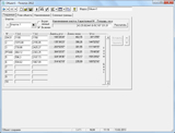
Полигон 2012
Download URL | Author URL | Software URL | Buy Now ($0)
"Range" is a unique program for automation of a land surveying and tap of the earths.
The program carries out calculation of the geodata, builds the plan of borders of the earths, forms землеустроительное business. It is compatible to programs Word, Excel, MapInfo, AutoCAD, supports data input from files тахеометров. At a maximum of possibilities the program is simple and convenient, it is recommended for broad audience землеустроителей.
Possibilities:
Input of coordinates and names of points of sites and calculation of a return geodetic problem: calculation of a corner and distance on two points with known coordinates.
Input of corners and lengths of lines and calculation of a direct geodetic problem: calculation of coordinates (taking into account automatic distribution are nonviscous also amendments) on available corners and lengths of lines.
Input and calculation of the given field measurements (shooting from a firm line, polar shooting, a line and displacement).
Listing
