Global mapper 9.972
Download URL | Author URL | Software URL | Buy Now ($299.95)
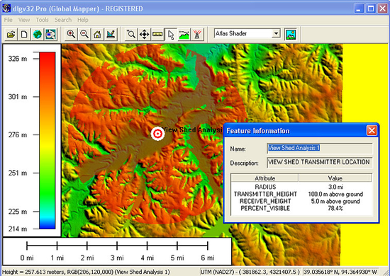
Global Mapper is more than just a utility; it has built in functionality for distance and area calculations, raster blending, feathering, spectral analysis and contrast adjustment, elevation querying, line of sight calculations, cut-and-fill volume calculations, as well as advanced capabilities like image rectification, contour generation from surface data, view shed analysis (including Fresnel) from surface data, and triangulation and gridding of 3D point data. Repetitive tasks can be accomplished using the built in scripting language or comprehensive batch conversion functionality.
There is not a GIS tool who compares with Global Mapper when you need to manage simultaneously the most variated types of data such as altitude files, vector data and raster or ASCII files with different coordinate and projection systems, all at the same time, and into one of the most simple and user friendly environment you ever seen.
With Global Mapper you can produce ouputs that are impossible to do wi
Related software (5)

DXF Works
DXF Works is an application that allows to extract coordinates and other various data from DXF files. You can choose which entities to process and which data to extract, creating y ...

DXF Works
DXF Works is an application that allows to extract coordinates and other various data from DXF files. You can choose which entities to process and which data to extract, creating y ...

SQLDirect .NET
An enhanced data provider for SQL Server-based database applications development that offers both high performance native connectivity to the SQL Server database and a number of in ...

east-tec SafeBit
east-tec SafeBit 2 features military strength on-the-fly AES encryption, by creating virtual drives, where you can hide files and folders, keep them encrypted all them time, but st ...

Geodata International
Geodata International - World-wide database of countries with georeferenced towns, municipalities, postal codes and administrative units with WGS84 and UTM coordinates and elevatio ...
