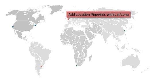
Interactive flash world map
Download URL | Author URL | Software URL | Buy Now ($0)
A professional-quality interactive world map that can be customized for your unique needs. This is the ideal solution for displaying global offices, travel information, dealer locations, or just visualizing country statistics. You can easily customize almost every aspect of the map and we've worked hard to make installation painless. Includes smart zooming, pinpoint locations (using latitude/longitude) and pop-up information on mouse over.
Related software (5)

KT Text Filters
Extract textual contents from numerous file types such as, DOC, RTF, HTM, HTML, PDF, XLS, XML, PPT, HLP, TXT, etc. Text extraction is provided into either plain text (trial version ...

FlyCharts Flash Chart Component
FlyCharts is a chart flash component. It is a set of Adobe Flash (SWF) files that gives an outstanding possibility to visualize data. FlyCharts help create compact, interactive and ...

XML Data Extractor Software
XML Data Extractor Software loads internet or local Source files and automatically extracts Source file data allowing it to be easily used as input for web forms or applications.

Flash USA Map
Flash USA map of the United States. This interactive united states map has clickable states that contain information about all 50 states. Map is easily installed using XML and SW ...

CADEditorX: ActiveX DWG/DXF, STP, PLT
The ActiveX library allows integrating CAD features in such environments as .NET, HTML / JavaScript, VC++, Delphi, C++Builder, etc. It supports a large number of formats including ...
