Klonk map measurement
Download URL | Author URL | Software URL | Buy Now ($39)
Fast & Easy measure distances and areas on the ground on earth.
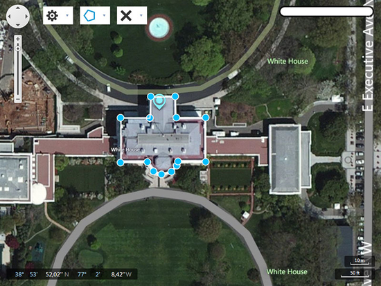
Map Measurement uses lines and shapes to check one or several distances and estimate sizes of different features on Earth. With Map Measurement, you can measure the length with a line or path, you can also measure areas using polygons. You can measure several different measurements on one map.
HOW TO CREATE A MEASUREMENT
Open Map Measurement.
Navigate to a spot on the globe by zooming, or enter an address in the search field of your interest.
Select the drawing method which you want to use(the latest used is already selected).
Line:the distance between two points on the map
Path:the distance between multiple points on the ground
Polygon:the distance or area of a geometric shape on the ground
On the map, click a starting point for your measurement.
Depending on figure type click until you have drawn the figure that you want to measure.
End the drawing by right or double clicking or by selecting the end drawing label. Except
Related software (5)

ABF Value Converter
ABF Value Converter is an application for measurement units conversion. This software easily converts various measurement values into any other possible ones. Inches to centimetres ...

Geo World
Geo World is a handy application for finding out detailed information about any country in the world.

ORTWIN
ORTWIN is a program for the inquiry of localities in Germany. It finds postal zip codes, telephone pre selections, coordinates. It performs perimeter searches and distance calculat ...

ESBUnitConv Pro
Unit Conversion Software for Windows to easily convert between 938 units of measurement. Includes Units for Temperature, Distance, Mass, Area, Volume, Pressure, Velocity, Accelerat ...

Colonization Hex
Claim your dominion by unifying the color of the tiles!
