Major usa cities and highways
Download URL | Author URL | Software URL | Buy Now ($399)
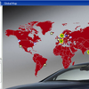
Major USA Cities and Highway Map has been developed for the business-minded people, who need quick and on-hand access to the network of US roads. It is a rather simple version of professional software with several background images and a nice monitor glass projection.
With our user-friendly USA Cities and Highways Map it is possible to:
• add/remove locations
• hide/show roadways layer
• customize general look and feel
• find your location in seconds with a possibility to link objects to specific URLs
This map is a directory and a guide to major USA cities and state tours. It is delivered with source files, so adding or removing cities is really simple and fast. Moreover, you are sure not to have any problems while installing it, since we guarantee a 5-minute installation and configuration process.
Related software (5)

AnyChart Flash Map Component
Anychart Flash Maps Flexible XML-Driven solution: US, World, US Counties. You can add background and captions, XML data file and a set of customizable options make AnyChart Maps a ...

Area Selector
With Flash Area Selector Map, real estate map with integrated multiple functions, you can • Make complex geo spatial selection using intuitive interface • Choose custom color schem ...

World Map in Flash
Use our map -- to show international offices (international affiliates, hotel networks), --to improve search providing info on any country or region, --as a real estate or other ma ...

USA Real Estate Map Pro
With Real Estate Pro you can visualize your data, shade regions, see 51 states of the USA on the National View, use advanced search, add cities or custom locations according to the ...

USA Real Estate Map Pro
With Real Estate Pro you can visualize your data, shade regions, see 51 states of the USA on the National View, use advanced search, add cities or custom locations according to the ...