Topowin
Download URL | Author URL | Software URL | Buy Now ($125)
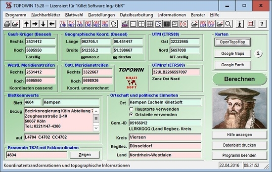
TOPOWIN is a state-wide register of the German Topographic Cartographies, the German Basic Cartography and of localities with geo references in different coordinate systems. It is also a topographic information system. In the division of planning and execution of economical and scientific projects frequently topographic documents are used. The program TOPOWIN makes information available of the official topographic cartographies and the German Basic Cartography from the entire national territory in suitable graphic views. It accomplishes different coordinate transformations and inquiries. The program was developed under co-operation of the land surveying authorities of many German Federal States. For the first time in the previous version TOPO (for DOS) and later in TOPOWIN state-wide topographic information were arranged for the data technical evaluation. The program is for consulting engineers, planning authorities and users of topographic maps a useful and versatile tool. The topogra
Related software (5)

Geo World
Geo World is a handy application for finding out detailed information about any country in the world.

MAPS.ME for Android
Access worldwide offline maps with navigation & driving directions! Travel easy!

ASTRA - Advanced Sysinfo Tool
This program performs computer configuration analysis and diagnostics. It gives detailed information about your computer hardware and devices operational modes, including undocumen ...

TRANSDAT
TRANSDAT Coordinate Conversion supports thousands of coordinate systems and geodetic datum shifts, user-defined systems, INSPIRE, NTv2, BeTA2007, GPS, continental drift, Shape, KML ...

GeoDLL
GeoDLL supports the development of geodetic software on various platforms by providing geodetic functions. GeoDLL contains precise calculations on the themes 2D and 3D coordinate t ...
